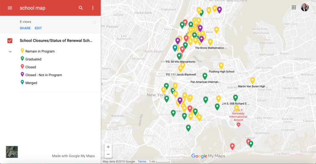
Here is a map of the status of NYC Renewal schools as of 2018. This map also includes schools outside the Renewal program that were closed. Click here to view the general map interactively.
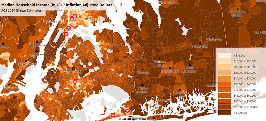
Next, here are maps made using Social Explorer and ACS Data of all the Renewal schools mapped over median income and white population density within census tracts. At a glance, it is clear that the schools in the program are not isolated incidents within their communities. The struggles that each school faces are mirrored in the neighborhoods they reside in. Schools do not exist in a vacuum; neighborhood effects both influence, and are influenced by schools.
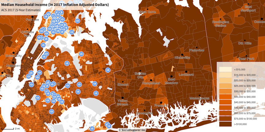

Finally, here are maps made using Social Explorer and ACS Data showing only the schools closed over the de Blasio Administration mapped over median income and white population density within census tracts. These maps that look at the extremes of failing schools — schools that have been closed by the city — show an even more severe picture of the previous message: neighborhoods matter.